Chile Hit by Worst Rains in 30 Years: Four Dead, 325,000 Homes Without Power
USD 21,04
Popular
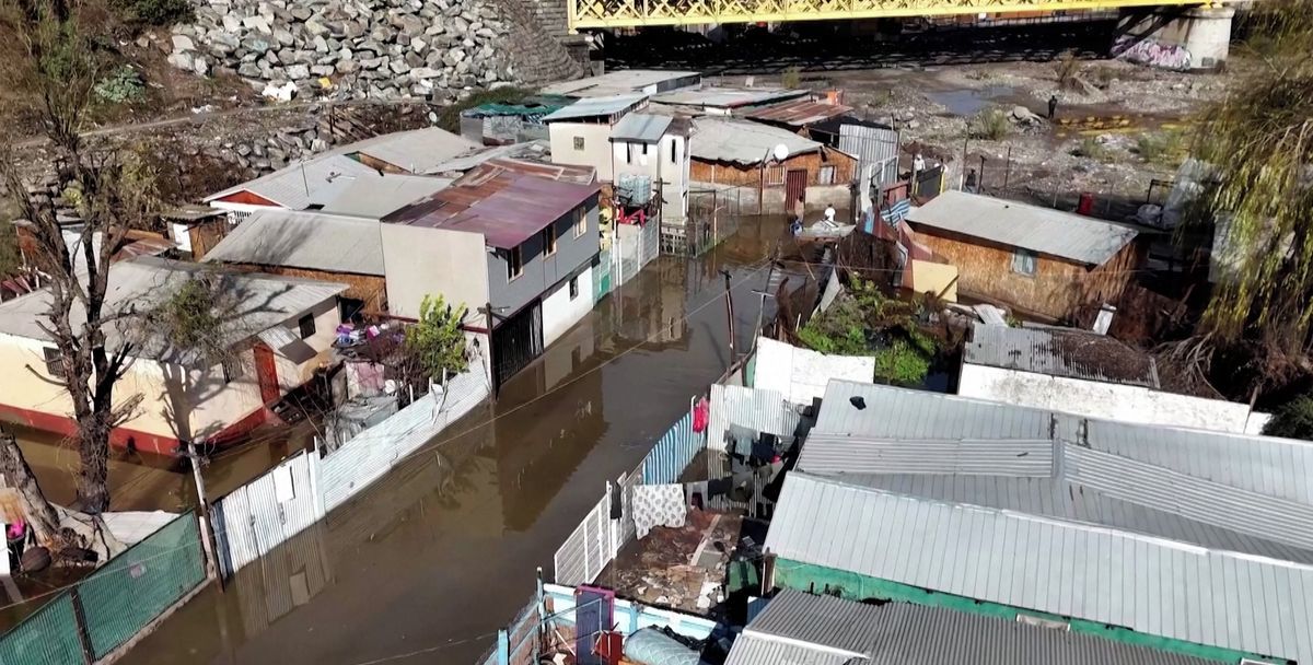
Chile has been battered by catastrophic downpours since the start of last week — according to local authorities, some northern regions of the country, where such rainfall is extremely rare, received a year's worth of precipitation in just a few hours. Flooding and landslides have killed at least four people, with hundreds of homes seriously damaged.
As of Sunday, nearly 325,000 households — around four percent of all grid connections nationwide — remained without electricity. Thousands of residents have been forced to leave their homes.
According to the Spanish newspaper El País, the situation is most severe in the Atacama, Coquimbo and Valparaíso regions, where the highest alert level has been declared due to the risk of flooding and landslides. A lower-level alert remains in effect in seven other regions of the country, including the capital region of Santiago.
The situation was made worse by hurricane-force winds with gusts exceeding 160 km/h. On Thursday, in the city of Coquimbo, a gust of wind toppled a construction crane onto residential buildings — media reports say one person was injured.
Meteorologists warn that heavy rain and wind will continue to threaten the affected areas until at least Wednesday, after which the weather is expected to gradually stabilise, with minimal precipitation forecast by the end of the week.
The unusual downpours were caused by an "atmospheric river" — a narrow, elongated band of air carrying large amounts of water vapour from the tropics to higher latitudes. When such a stream reaches land, it can trigger extreme rainfall and sharply increase the risk of flooding.
The strength of the current atmospheric river has been further amplified by El Niño, which warms the tropical Pacific Ocean and alters atmospheric circulation over its southern waters. This leads to more frequent and intense formation of frontal systems that bring heavy rainfall to Chile.
According to the latest measurements, the sea surface temperature deviation in the monitored zone of the tropical Pacific is around +2°C — a figure consistent with a very strong El Niño, sometimes referred to by meteorologists as a "super El Niño".
Experts note that such a pronounced phase of the phenomenon has developed unusually early this year. In the coming months, El Niño is expected to raise the risk of extreme weather events — devastating floods and droughts — in many regions of the world.
Source: novinky.cz