Czechia Faces Cold Mornings and a Scorching Weekend with Temperatures Above 35°C
USD 21,00
Popular
A cold front swept across Czechia on Monday, bringing temperatures down by roughly 5-10°C. Once it clears, though, the weather will be shaped by a powerful anticyclone moving west to east across Europe, and sunny skies with minimal cloud cover are expected to dominate for most of the week.
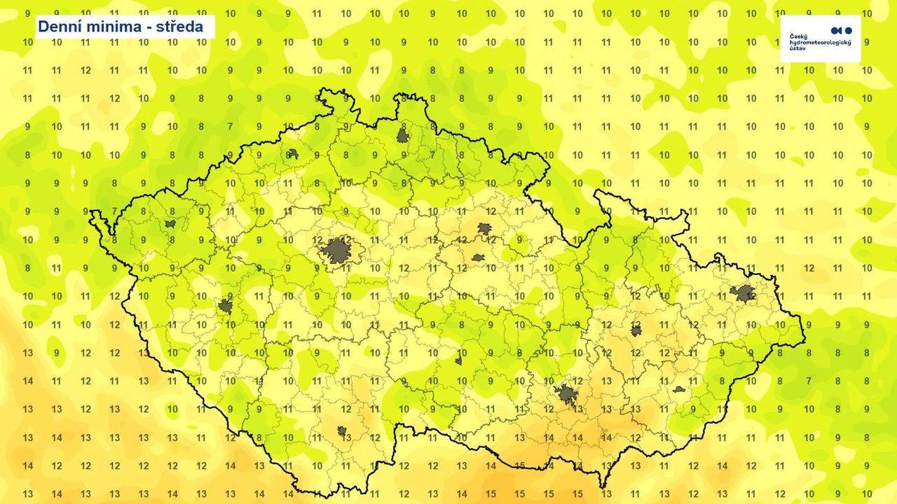
The coldest morning is expected as early as Wednesday, with temperatures dropping below 10°C in many regions. It will stay milder in low-lying areas, particularly in southern Moravia, where overnight lows may hover around 15°C. Cool nights will persist through much of the week, but a sharp warm-up over the weekend could push nighttime temperatures in some spots close to 20°C.
A Folk Saying Comes True — Belatedly
The well-known Czech saying "St. Anne brings cold mornings" will hold true this year, albeit later than usual. Overnight temperatures have recently been running above normal for this time of year, and the approaching cool spell should finally help homes and flats that have grown overheated cool down.
During the day, the picture will be the exact opposite: thanks to sunny weather, temperatures will climb quickly — first to slightly above-average levels, then noticeably higher still.
Heat Returns for the Weekend
Through Thursday, daytime highs will mostly range between 25 and 30°C, with the warmest lowland areas possibly reaching tropical values around 30°C. From Friday, the heat will return in full force, and over the weekend maximum temperatures could exceed 35°C in places.
This extended stretch of sunny weather will come with downsides too. After scattered showers and thunderstorms on Monday, almost no precipitation is expected for the rest of the week. The first rain may not reach the western part of the country until a cold front moves in on Sunday. As a result, the drought affecting Czechia is set to intensify further.
Source: novinky.cz