El Niño Is Gaining Record-Breaking Strength — Climatologists Call It an Unprecedented Event
USD 21,65
Popular
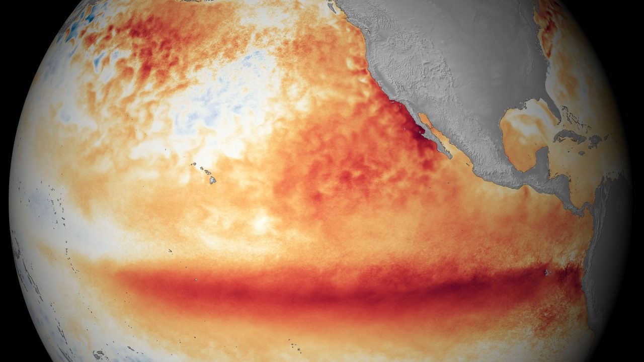
The temperature anomaly in the ocean's key Niño 3.4 region reached +2.03°C in July, and according to data for the week centered on August 12, the figure temporarily spiked to +2.7°C. This is according to the International Research Institute for Climate and Society (IRI). Values above +2°C already qualify as a very strong event, informally referred to as a "Super El Niño."
Current readings are already noticeably surpassing the peak of the previous El Niño in 2023 and are approaching the strongest cases on record. Yet the peak of the current event isn't expected until the end of the year.
A Hidden Reservoir of Heat Beneath the Surface
An enormous amount of energy has built up beneath the ocean's surface: in some areas of the equatorial Pacific, at a depth of around 100 meters, the water is warmed to up to 8°C above normal. It's precisely this reserve of warm water that could fuel further intensification of El Niño in the coming months.
"There are still many months ahead during which this event will continue to develop. That's exactly why we're becoming increasingly confident that we're looking at a record-breaking event," climatologist Zeke Hausfather of the American research group Berkeley Earth told the BBC.
Forecasts Sound the Alarm
Of the 26 models included in IRI's August forecast, 25 predict a very strong El Niño this autumn, and 15 models allow for an anomaly of at least 3°C in the Niño 3.4 region.
The UK's Met Office is forecasting an equally extreme scenario. "We need to be clear: this is an unprecedented event. I've never seen such an intense El Niño signal in our forecasts before," said Adam Scaife, head of long-range forecasting at the Met Office.
Some individual forecasts go even further. If the most extreme scenarios come true, with an anomaly of around four degrees, Hausfather says it can't be ruled out that this could be the most powerful El Niño in the last 500 or even 1,000 years. That said, it's no longer possible to determine the intensity of events from such a distant past with any certainty.
Read also: Prague Metro: Map and Tickets
Source: novinky.cz