Real-Time Satellites: How Ukrainian Drones Locate Targets in 15 Minutes
USD 21,62
Popular
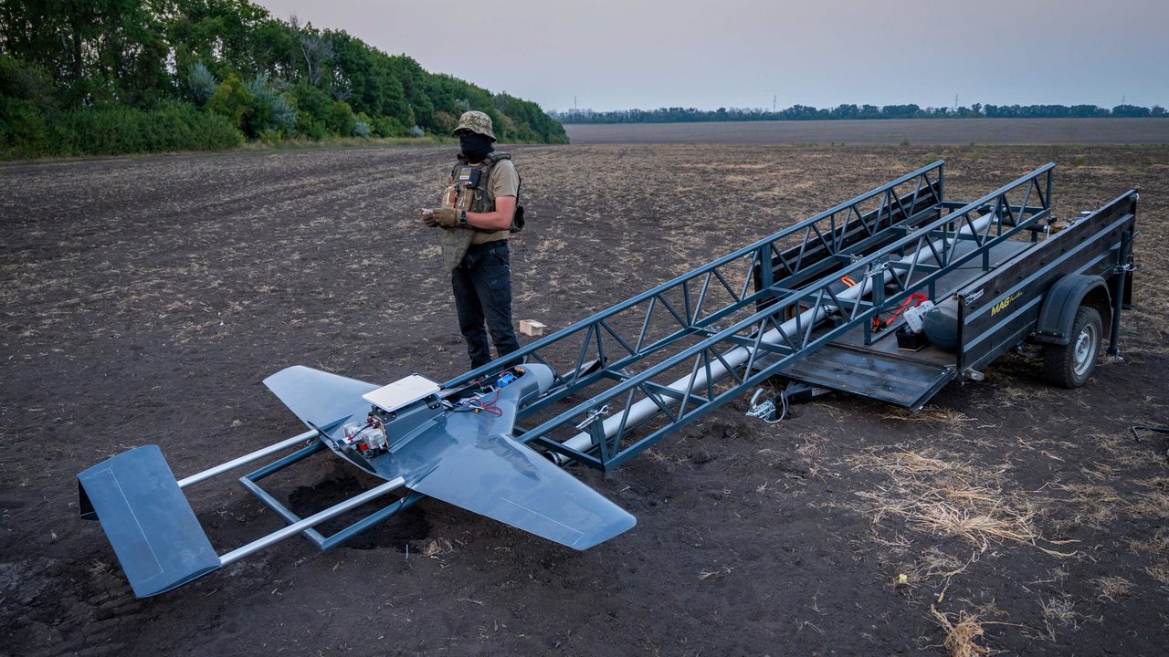
One summer night, Ukrainian drone operators known by their call signs Teplo and Tykhyi hid a small truck under trees on the edge of a forest. They assembled a drone armed with two bombs and sent it toward a spot where Russian drone operators had settled in for the night shortly before. "Target confirmed," Tykhyi reported, and the drone struck. The New York Times reports.
The truck served as a mobile command post, its computer linked directly to commercial satellites. The first strike had to be aborted due to a Russian glide-bomb attack, but the operation was repeated a few days later — this time punching two large holes through the roof of a house where Russian drone pilots were sleeping.
Imagery With Almost No Delay
Dutch-made equipment allowed the two soldiers to receive high-quality satellite images in near real time — sometimes within just 15 minutes, sometimes within a few hours, but never after the two or three days it used to take, by which point the enemy had usually already relocated. The only remaining delay comes from the need for approval from a senior commander, a step meant to prevent strikes based on faulty targeting.
"This is an incredibly useful capability," said Major Mykola Kolesnyk, commander of the 422nd Separate Unmanned Systems Regiment, where Teplo and Tykhyi serve.
This summer, soldiers from the regiment used fresh satellite imagery to locate and destroy several military sites in the occupied part of Zaporizhzhia region, as well as to strike air-defense systems in Crimea — in areas where Russian forces jam Starlink signals. In the past, Ukrainian troops relied on reconnaissance drones to get an up-to-date picture, but these could be shot down or jammed, and their very appearance often tipped off Russian commanders to danger.
More Satellites, More Data
Satellite imagery gives no such warning. In the past, such images from Western allies were scarce and reserved for top commanders, and even then supplies were never guaranteed: in March 2025, US President Donald Trump ordered a halt to the Pentagon's sharing of satellite imagery with Ukraine, though he later reversed the decision.
Over the past year, access to satellite data has expanded considerably — thanks partly to the US government, but mainly to private companies. Vantor, a firm that has worked with Ukraine for years, recently launched six new satellites into orbit, bringing its total fleet to ten.
Vantor's satellites can photograph the same patch of terrain up to 15 times a day, helping the military track Russian troop movements. "Essentially, we hand them a satellite, and they decide what to shoot at," said Vantor director Will Cochos.
The widespread use of drones and satellite imagery has already reshaped the nature of the fighting. Russia has responded to the threat by hiding its equipment. "We haven't seen a tank in our regiment in six months — the ones we have are hidden in dugouts," Major Kolesnyk noted.
The Smallest Details Matter
Spotting the equipment itself isn't even necessary anymore. With extensive archives of satellite imagery, the military can detect even the tiniest changes on the ground — felled trees or tire tracks across a field.
That's exactly how Teplo and Tykhyi, comparing images from different periods, found a target near a house in Kherson region where, on the surface, nothing seemed to be happening for weeks. Satellites picked up tire tracks near a small grove, and a strike on the spot confirmed the analysis was correct — several pieces of equipment blew up there.
"This looks like a genuine revolution in warfare," said a military expert at Britain's Royal United Services Institute (RUSI).
Read also: Mobile Operators in Czechia: Which One to Choose in 2026
Source: novinky.cz