What the Amber Wind Warning for Storm Boelo Means for Travel and Safety in Scotland

USD 21,74
Popular
The Met Office has upgraded its wind alert for Storm Boelo to amber, warning of possible injuries and a danger to life from flying debris across mainland Scotland and the Western Isles this weekend. Gusts of up to 80 mph are forecast in exposed coastal areas, and travel by road, rail, air and ferry is likely to be disrupted.
The amber warning runs from 9 p.m. Saturday, Oct. 24, until 9 p.m. Sunday, Oct. 25, according to STV News and Aberdeen Live. It replaces an earlier yellow warning that had been due to start at noon on Saturday, STV reported.
What this means for getting around
The Met Office said road, rail, air and ferry services are likely to be affected, and that roads and bridges may close, Aberdeen Live reported. Even short journeys could become hazardous as conditions change quickly, London Business News reported.
The Met Office advised drivers who must travel to slow down to reduce the effect of sudden gusts, and said driving in these conditions can be dangerous. It also urged people to check travel information before setting out, according to London Business News.
What it means for safety at home and outdoors
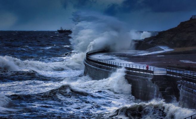
Forecasters said flying debris could cause serious injuries. Tiles could be blown from roofs, and large branches or whole trees could come down. Aberdeen Live also reported a risk of power cuts, and the Met Office pointed to large waves and dangerous coastal conditions.
The Met Office told people to stay indoors as much as possible during the worst of the weather. Anyone who goes out should try not to walk or shelter close to buildings and trees. London Business News also reported advice to secure loose outdoor objects and to keep following official weather updates.
How strong the winds are expected to be
The Met Office expects fairly widespread gusts of 60 to 70 mph, with gusts to 80 mph in exposed coastal areas. The strongest winds will first hit western Scotland and the far north of Northern Ireland on Saturday evening. They will then spread eastwards overnight and through Sunday, with periods of heavy rain and frequent showers. The winds should gradually ease from the west during Sunday.
The Met Office said confidence in impacts and disruption is higher inside the amber area than in the wider area covered by a yellow warning, according to Aberdeen Live. London Business News reported that an amber warning reflects a high likelihood of severe impacts, estimated at 50-75 per cent.
Where the warning applies
According to London Business News, the amber area covers much of Scotland. That includes Aberdeen, Aberdeenshire, Moray, Highland, Na h-Eileanan Siar, Angus, Dundee, Fife, Perth and Kinross, Stirling, Argyll and Bute, Glasgow, Dumfries and Galloway, Edinburgh, the Lothians and the Scottish Borders.
The warning also takes in Northumberland and Cumbria in England, and County Antrim and County Londonderry in Northern Ireland.
Rain from Storm Austen came first
Boelo is the second named storm of the season, following Storm Austen, which brought heavy rain to Scotland on Friday, STV reported. A Met Office rain warning covered central, southern and north-east Scotland until midnight Friday. Totals of 20-40mm were expected widely and 60-80mm in some places, with a small chance of flooding to homes and businesses.
Police Scotland said the B9071 in Shetland was closed between Garderhouse and the Reawick junction in Skeld after a landslide. Network Rail put speed restrictions on routes to and from Aberdeen, between Glasgow Central and Carlisle, and between Glasgow Central and Edinburgh Waverley. The Scottish Environment Protection Agency had 11 flood alerts in place in the areas covered by the yellow rain warning.
Chris Bulmer, the Met Office deputy chief forecaster, said the two systems together would make for an “impactful weekend of weather” across Britain, according to London Business News.
What happens next
The amber warning stays in force until 9 p.m. Sunday. Forecasters expect the winds to ease from the west during the day, so conditions in eastern areas may stay severe for longer.
Around Prague, based on reporting by STV News, Aberdeen Live, London Business News